Kinnoull Hill Woodland Park
The Fort wasn’t really known about until 1922 when it was described in a Chalmer-Jervise Prize Essay of the Society of Antiquaries of Scotland written by a certain R.R. Boog Watson.
In this essay he describes how the Fort was discovered and the early excavations that were made. It also includes a reasonable map of the site.
Click on the map for a larger view.
Excerpt from the Boog Watson essay:
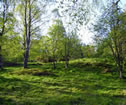
Viewed from the west, Deuchny Hill has the appearance of a truncated cone, but from south or north it is elongated, and consists of three well-defined heights rising in level from the west end.
Both to the north and south are swampy hollows, beyond which the ground again rises, but nowhere attains the height of the eastmost top.
This height commands a very extensive outlook: eastwards, the Carse of Gowrie and as far as the Bell Rock light; southwards, from St Andrews Bay and over Fifeshire; westwards, Strathearn and to about Tyndrum; northwards, the valley of the Tay, Strathmore, and the Grampians.
Only to the north-east is the view cut off by Murrayshall Hill. So prominent is the site that it was selected for the Peace Celebrations bonfire, and it was this circumstance which redirected my attention to it.
I had at an earlier time noticed what seemed to be traces of a wall, but having examined the Ordnance Survey Maps and finding no indication of any site, I had concluded that either I was mistaken or the remains were quite modern.
When, however, a small stone mortar was brought to the Perth Museum as having been found on the site of the bonfire, I was led to re-examine the site.
If you want to read more the full essay can be viewed here.


